Data retrieved: 2026-07-04
Map: GSI base tiles. ● marks the subject location. Hazard-layer maps appear in each chapter.
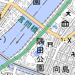
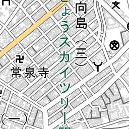
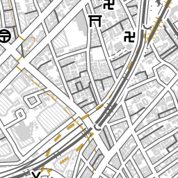
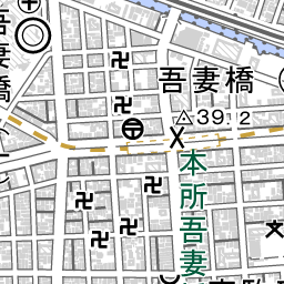
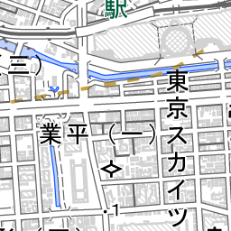
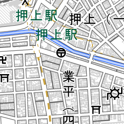
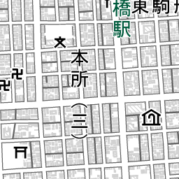
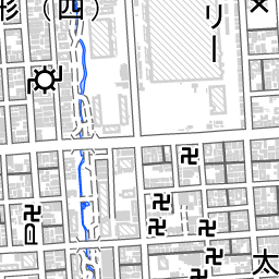
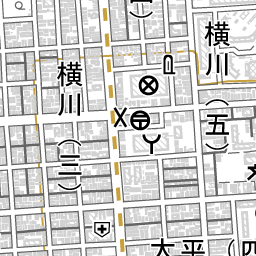
Map: GSI base tiles. ● marks the subject location. Sources: GSI Japan & Overlay Hazard Map. Switch the official hazard layers (flood / storm surge / tsunami / landslide — maximum-scale assumptions) with the buttons above; zoom and pan freely. In print/PDF, hazard-layer maps appear in each relevant chapter.
Overall assessment
Check the address for free first — the full English report is $120 per address, delivered on screen and by email right after checkout.
Flooding — depth, time to recede, house-collapse risk
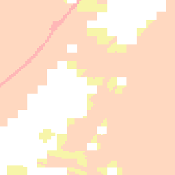

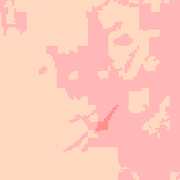






Official "Flood" hazard layer (maximum-scale assumption) around the subject location (●).
Sources: GSI Japan & Overlay Hazard Map.
The flood-coverage portion of fire insurance costs roughly ¥20,000 a year as a guide. A one-off loss and an annual premium are not directly comparable, so we convert the loss to an annual basis using the exceedance probability of each flood scale. On that basis the flood risk at this location is equivalent to ¥112,000–¥330,000 per year (a planning-scale flood assumption also applies here, and is included). That exceeds the ¥20,000 guide premium: on this measure, flood coverage is on the worthwhile side for this property. Also confirm contents (household goods) flood coverage — it is a separate rider from the building.
Assumptions: floor area 110m², one household, one vehicle, floor height 45cm above ground; prefectural unit value for the building; slope class inferred from the microlandform classification.
Storm surge — seawater during typhoons


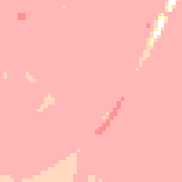






Official "Storm surge" hazard layer (maximum-scale assumption) around the subject location (●).
Sources: GSI Japan & Overlay Hazard Map.
Earthquake — probability of shaking, and ground amplification
Japan measures shaking with the JMA "shindo" intensity scale (0–7) — it describes what happens where you stand, not the earthquake's magnitude. Rough feel: 5-upper = hard to walk without holding on · 6-lower = hard to stay standing · 6-upper = impossible to stay standing, unsecured furniture is thrown · 7 = the scale's maximum.
Source: 東京都都市整備局「地震に関する地域危険度測定調査(第9回)」(令和4年9月公表) (CC BY 4.0). Tokyo's own survey, one level finer than the national 250m mesh; ranks are relative within Tokyo.
Liquefaction — is the ground itself vulnerable to shaking?
Landslide & tsunami
The land's origins and elevation — the root of the risks
- This point sits at 0.8m. Within 500m the ground ranges from -2m to 5.8m, and the lowest direction is NE — that is where surface water drains.
- The nearest ground 5m higher than this point is 2,740m away to the W — roughly 34 minutes on foot. Standing on the site you cannot tell this; it decides whether leaving on foot is realistic.
- Looking out 3km, 0 of the 8 compass directions are at least 10m higher than this point (elevation ranges -2.8m to 14.9m). With no higher ground in any direction, water spreads out rather than piling up — but it also means there is nowhere close to escape to.
Source: GSI digital elevation model
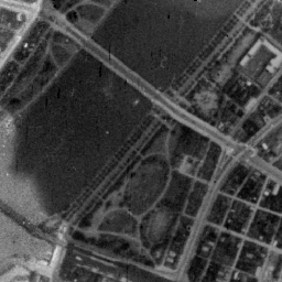
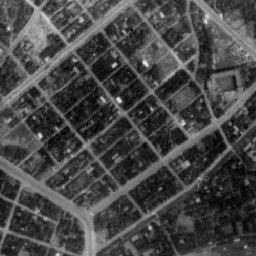
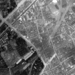
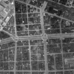
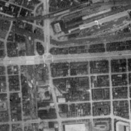
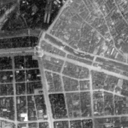
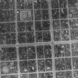
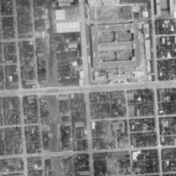
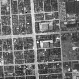
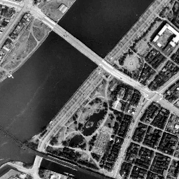
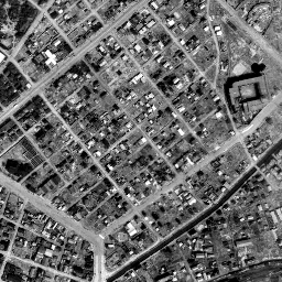
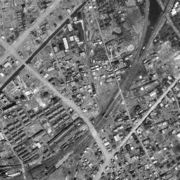
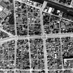
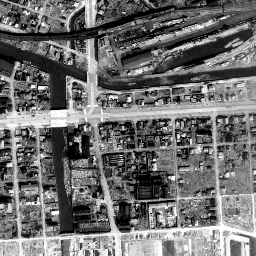
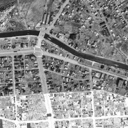
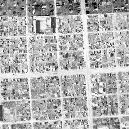
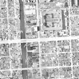
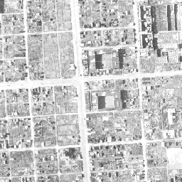
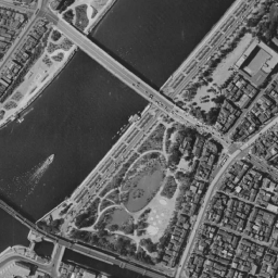
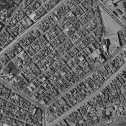
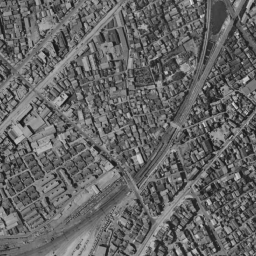
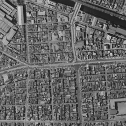
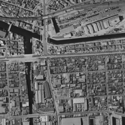
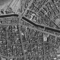
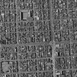
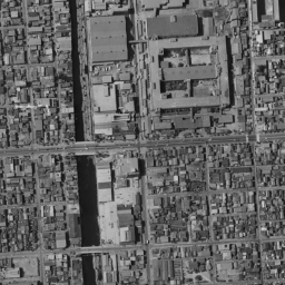
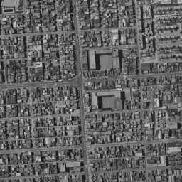
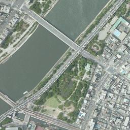
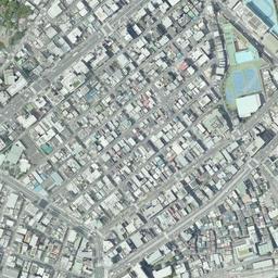
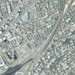
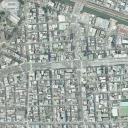
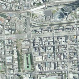
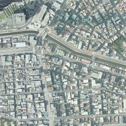
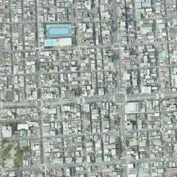
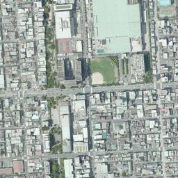
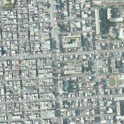
Aerial photographs of the same location across time. Source: Geospatial Information Authority of Japan (GSI) tiles. The circle marks the property in every frame.
- Dark, winding bands are former river channels. Ground there is often soft and prone to liquefaction.
- Regular grids of small rectangles are paddy fields — low, wet land that was later filled and built on.
- A straight coastline that appears only in later photos indicates reclaimed land.
- If the surrounding area was built up long before this plot, this plot was likely the harder land to build on.
Evacuation — where to flee, and where to stay
Shelter names are shown in Japanese, exactly as they appear on local signs — that is what you (or anyone helping you) will need to match on the ground. Addresses are romanized for readability. Tap Map › to open each site in Google Maps.
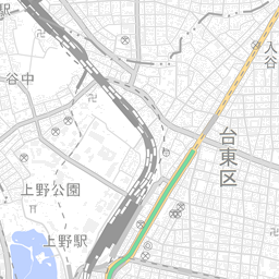
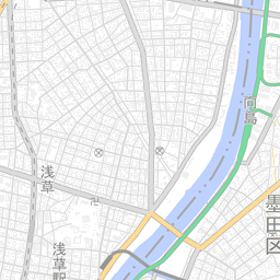
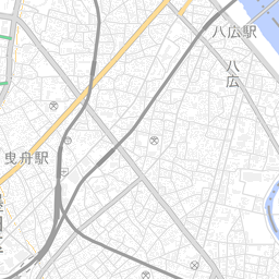
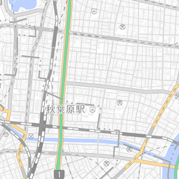

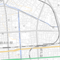
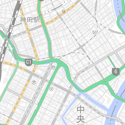
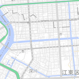

Flood-capable designated emergency evacuation sites (GSI national dataset; covered hazards: flood, storm surge, inland flooding). Distances are straight-line; walking assumes 80m/min. Municipally designated sites may be missing — always confirm with the official shelter list of Sumida City (墨田区).
Source: GSI “designated shelters” dataset. Facilities for staying after a disaster makes your home unlivable — not guaranteed to open during a flood. Distances are straight-line; walking assumes 80m/min.
If you live here — preparation priorities
- Earthquake insurance in Japan is a government-backed scheme, so the premium does not depend on which insurer you use — it is set by prefecture and building structure. For 東京都, the published annual rate per ¥10,000,000 of cover is ¥27,500 for fire-resistant construction (steel/reinforced concrete) and ¥41,100 for non-fire-resistant construction (typically wood).
- Earthquake cover is capped at 30–50% of the fire policy's sum insured. Taking the upper end, the building would be insured for about ¥17,600,000, which costs roughly ¥48,400 a year if the structure is fire-resistant, or ¥72,300 a year if it is wooden. The structure of this specific building is not something this report can see — it is one of the questions to put to the seller.
- Household contents are insured separately, capped at ¥10,000,000. Insuring them to that cap costs about ¥27,500–¥41,100 a year depending on structure. This matters here because liquefaction damage to a building is covered by earthquake insurance and by nothing else.
- If the building was newly constructed on or after 1 June 1981, a 10% discount applies, bringing the building premium to roughly ¥43,600–¥65,100. Larger discounts (10/30/50%) apply if the building holds a certified seismic grade, and 50% for base-isolated buildings — worth asking about, since they are claimed by the policyholder, not applied automatically.
- Flood coverage is different: it is each insurer's own product, with no published rate, and it varies with the building. We therefore do not put a computed figure on it. The working guide is around ¥20,000 a year — treat that as an order of magnitude, and get an actual quote.
Source: Japan Ministry of Finance, published earthquake-insurance base rates (effective for policies starting on or after 1 October 2022). Earthquake premiums are computed from the base rates published by Japan's Ministry of Finance, applied to a sum insured derived from this building's assessed value. Actual premiums vary with the sum insured, the policy term and which discounts apply. This is decision material, not a recommendation to buy or decline cover — consult an insurer or a licensed adviser.
Before you buy or sign — what to ask and check
- At the legally required property disclosure (jūyō jikō setsumei), receive the flood hazard map explanation (mandatory since 2020) and check that it matches this report
- Check for a raised foundation or ground elevation work (where flooding is assumed, floor height directly becomes the difference in damage)
- Check where electrical equipment, the water heater and AC outdoor units are mounted (ground level, or raised?)
- Ask the municipal office (墨田区) for past flooding and disaster records at this location
- Request the geotechnical survey report (essential for detached and custom-built houses)
- Confirm liquefaction countermeasures (pile foundations, ground improvement) and their details
- Confirm the building meets the post-1981 "new seismic standard" — ideally ask for its seismic grade
- Get a fire (with flood coverage) and earthquake insurance quote before you commit to the purchase
- For condominiums: check where the electrical room and water tanks sit (basements mean long outages if flooded) and the building's disaster plan
- Walk the evacuation route yourself — imagining night, and rain
Below is a message you can send to the seller or agent as it is. It is written in Japanese because that is what they read; forward it to your agent and it will do its job. Each item is followed by an explanation, in English, of why it is worth asking — those explanations are for you, and are not part of the message.
- Since August 2020, Japanese real-estate agents are legally required to show where the property sits on the municipality's own flood hazard map during the mandatory disclosure. Asking for the municipal map itself is the correct way to verify this — no third-party report, including ours, can substitute for it.
- The assumed inundation depth here is 0.5〜3.0m未満. Floor height translates directly into the size of the loss, and Japanese flood insurance typically pays out only above floor level or above 45cm from ground level — so this number decides both damage and coverage.
- If the distribution board, water heater and AC outdoor units sit low, even shallow flooding means long, expensive restoration. Whether they can be raised is worth knowing before you commit.
- Hazard maps show assumptions, not history. What has actually happened is known only to the seller, the neighbours and the municipality — there is no dataset for it, so it has to be asked.
- Floodwater here is assumed to take 1日〜3日未満 to recede. Where water lingers, the question is not only whether you can leave but whether you can stay — so what exists on the upper floors matters as much as the depth.
- On liquefaction-prone ground, buildings can tilt. A geotechnical survey report is usually produced at construction and held by the seller. Note that in Japan, liquefaction damage to a building is covered only by earthquake insurance — not by fire insurance.
- This location has a 83.2% probability of shindo 6-lower or stronger shaking within 30 years. Buildings whose construction permit was issued on or after 1 June 1981 meet Japan's post-1981 seismic standard — the permit date, not the completion date, is what determines this.
- Sellers in Japan have a duty to disclose defects they know about. Asking in writing is itself worth doing: the answer becomes a record you can rely on if a problem emerges later.
These questions are drawn from what applies to this specific address. They are not legal advice, and the seller is not obliged to answer every one — but asking in writing is itself worth doing.
The verdict — this property on the disaster axis
- There is an inundation assumption here (0.5〜3.0m未満). This is, however, the kind of risk that insurance, preparation and an evacuation plan can handle.
- The ground here is liquefaction-prone, which can leave a building tilted and damage buried utilities.
- There is a 83.2% probability of shindo 6-lower or stronger shaking within 30 years — high even by Japanese standards.
- Flood coverage can be added to the fire insurance — and note that contents (household goods) flood coverage is a separate rider from the building.
- There is a second floor or higher to move to, above the assumed inundation depth. A single-storey house, or a ground-floor unit, does not meet this condition.
- The distribution board, water heater and AC outdoor units sit above the assumed depth — or can be raised.
- Water is assumed to take 1日〜3日未満 to recede. You can store enough water, food, a portable toilet and a power source upstairs to cover that period at home.
- You can obtain the geotechnical survey report and confirm whether pile foundations or ground improvement were carried out. Note that liquefaction damage to a building is covered only by earthquake insurance, so that policy becomes a precondition.
- The building's construction permit was issued on or after 1 June 1981 (Japan's post-1981 seismic standard) — ideally, ask for its seismic grade as well.
This judgement covers the disaster axis only. Whether the price is fair, whether the location suits you, and the condition of the building itself (structure, age, foundation height, deterioration) are not visible in this report — those belong to the agent, an architect, or a home inspection.
Sources, and how to read this report
- Flood depth / duration / house-collapse zones / landslide / tsunami / storm surge: "Overlay Hazard Map" portal (MLIT & Geospatial Information Authority of Japan)
- Earthquake probabilities / landform class / ground amplification: J-SHIS, National Research Institute for Earth Science and Disaster Resilience (Probabilistic Seismic Hazard Maps, 2024 edition)
- Estimated losses: MLIT, “Manual for Economic Survey of Flood Control (draft)” (rev. April 2020) — damage-rate tables by inundation depth; and its supplement “Asset Unit Values and Deflators” (rev. June 2024) — prefectural building unit values.
- Historical aerial photographs: GSI tiles (c. 1936–1942 / 1945–1950 / 1961–1969 / latest), used under the GSI tile terms with attribution.
- Elevation and geocoding: GSI (Geospatial Information Authority of Japan) APIs
- Designated emergency evacuation sites: GSI dataset (based on municipal designations)
- Liquefaction potential: estimated from landform classification (Wakamatsu–Matsuoka method; guideline only)
- Tokyo town-block hazard survey: 東京都都市整備局「地震に関する地域危険度測定調査(第9回)」(令和4年9月公表) (CC BY 4.0)
› Full list of referenced datasets (sources, publication years, resolution — Japanese)
This report is reference information based on public open data. It is not a guarantee of safety, nor investment, purchase or insurance advice. Judgments are made at map-pixel or ~250m-mesh resolution, so values near a boundary may reflect the adjacent zone. For final confirmation, consult the municipality's latest hazard maps and offices. Shelter designations and their operating rules can change. Japanese terms (shindo, place names) are kept where translation could lose precision.